↓
 

Phoenix Land Surveying

Local Land Surveyors in Phoenix, AZ

Phoenix Land Surveying
  • Home
  • Home
  • ALTA Survey
  • Boundary Surveying
  • Construction Survey
  • Drone LiDAR Mapping
  • Elevation Certificate
  • Land Surveying
  • Topographic Survey
  • Blog
  • Contact Us
Home 1 2 3 … 6 7 >>

Post navigation

← Older posts

Welcome to Phoenix Land Surveying

Phoenix Land Surveying Posted on August 18, 2017 by PhoenixSurveyorMarch 24, 2020

Your Final Stop for ALL of Your Survey Needs!                                         Contact us today for a free quote!

This site is intended to provide you with information on Land Surveying in the Phoenix, AZ and Maricopa County area of Arizona. If you’re looking for a Phoenix Land Surveyor, you’ve come to the right place. If you’d rather talk to someone about your land surveying needs, please call our local number at (602) 600-6678 today. For more information, please continue to read.

land surveying
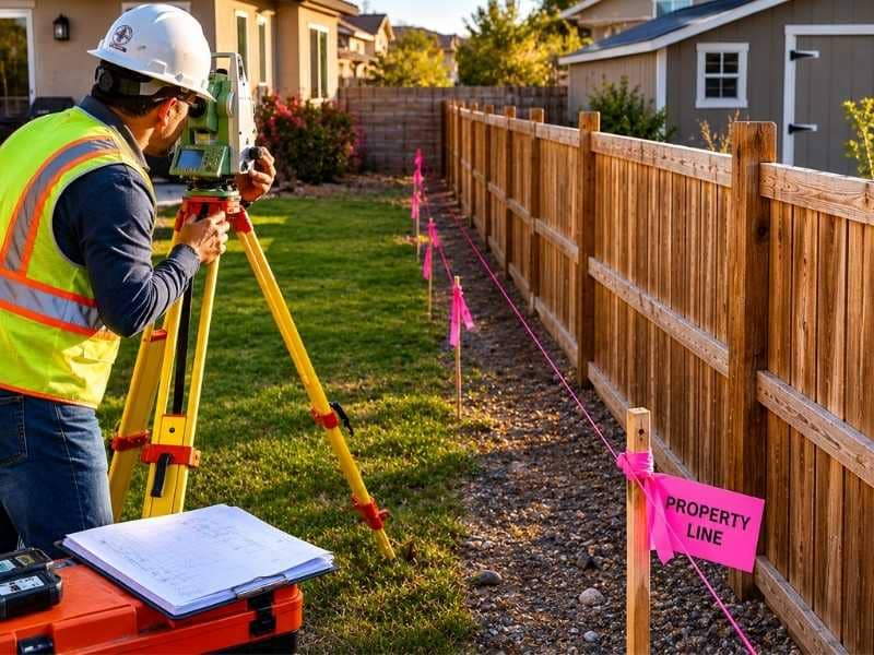
Land Surveyors are professionals who make precise measurements to determine the size and boundaries of a piece of real estate.  While this is a simplistic definition, boundary surveying is one of the most common types of surveying related to home and land owners. If you fall into the following categories, please click on the appropriate link for more information on that subject:

Phoenix Land Surveying services:

    1. I need to know where my property corners or property lines are. (Boundary Survey)
    2. I have a loan closing or re-finance coming up on my home in a subdivision. (Lot Survey)
    3. I need a map of my property with contour lines to show elevation differences for my architect or engineer. (Topo Survey)
    4. I’ve just been told I’m in a flood zone or I’ve been told I need an elevation certificate in order to obtain flood insurance or prove I don’t need it. (Flood Survey)
    5. I’m purchasing a lot/house in a recorded subdivision. (Lot Survey – See Boundary Survey if you’re not in a subdivision.)
    6. I’m purchasing a larger tract of land, acreage, that hasn’t been subdivided in the past. (Boundary Survey)

Contact Phoenix Land Surveying services TODAY at (602) 600-6678.

Posted in boundary surveying, elevation certificate, land surveying, land surveyor | Tagged boundary survey, land surveyor, land surveyor phoenix az, Phoenix Land Surveying

What Information Can Be Collected With LiDAR Mapping?

Phoenix Land Surveying Posted on June 12, 2026 by PhoenixSurveyorJune 12, 2026
Surveyor using drone technology and digital terrain models to collect data during a LiDAR mapping project.

LiDAR mapping collects detailed data about land and structures. Most people don’t know how much useful information comes out of it. Developers and engineers use LiDAR mapping to measure land, map buildings and study vegetation. This article explains what gets collected, how it works and why it matters for real projects.

What LiDAR Mapping Measures on the Ground

LiDAR fires laser pulses at the ground. The pulses bounce back and record the exact height of each point. Thousands of these measurements happen every second. Software then removes returns from trees and buildings, leaving only ground-level data.

What’s left is called a Digital Elevation Model, or DEM. It shows the exact shape of the land, including hills, slopes, flat areas and low spots where water collects.

Engineers use DEMs to plan grading and drainage before construction starts. A site may look flat to the eye but still have height changes that affect how water drains, where a foundation sits and how much earthwork a project needs.

What LiDAR Captures Above the Ground

LiDAR also records everything above the ground. Trees, buildings, fences and power lines all get captured in the same scan. This full-surface picture is called a Digital Surface Model, or DSM.

The DSM shows the site exactly as it looks right now, not just the bare ground. Planners use it to study shadows, check sight lines and understand how above-ground features affect a design.

If you subtract the DEM from the DSM, you get the height of everything sitting above the ground. That includes tree canopy heights across the entire site. Tree surveys, habitat studies and urban planning projects all use this data regularly.

How LiDAR Measures Buildings and Structures

LiDAR records the full shape of buildings in three dimensions. Rooflines, wall faces, overhangs and even small architectural details get captured accurately in a single scan.

This saves a lot of time on projects that need building measurements. A field crew doesn’t have to measure by hand. The LiDAR scan delivers a 3D model that designers and engineers can open and use in their software right away.

For roads, bridges and other infrastructure, LiDAR captures wall heights, clearances, road geometry and structural details across long distances. A single drive or flight pass collects all of it at once.

How LiDAR Sorts Vegetation Into Layers

LiDAR records several bounces from a single laser pulse. The first bounce hits the top of a tree. The next bounces hit lower branches. The last bounces reach the ground below the canopy.

This layered return data gets sorted into categories: tall trees, mid-level growth, low shrubs and bare ground. Each layer becomes its own data set that can be viewed and analyzed separately.

Developers use vegetation layers to find trees large enough to require removal permits. Environmental teams use it to map what plant types cover large areas without walking every acre. Site planners use it to estimate clearing costs before a project goes to bid.

What LiDAR Cannot See Underground

LiDAR does not see underground. The laser pulses only hit surfaces they can physically reach. Buried pipes, cables and tanks do not show up in LiDAR data at all.

Above ground, LiDAR does capture utility poles, overhead lines, surface-mounted equipment and access covers that are visible from the air or from a vehicle. That surface data, combined with utility records, helps engineers plan around existing infrastructure more accurately.

For road and pipeline corridor projects, a mobile LiDAR unit drives the route and captures the full geometry of the right-of-way in a single pass. The data feeds directly into design software with no manual entry needed.

How LiDAR Records Different Surface Types

Every laser bounce records how much light came back to the sensor. Hard surfaces like concrete and asphalt reflect more light. Soft surfaces like bare soil and grass reflect less. Each surface has its own signature in the data.

Engineers use this reflectivity data to identify what type of surface covers each part of a site. It helps separate paved areas from dirt, buildings from trees and dry ground from wet areas.

Water is especially easy to spot. It reflects very little light back to the sensor, so ponds, drainage channels, puddles and shorelines stand out clearly in the data.

How LiDAR Supports Flood Zone Analysis

LiDAR terrain data is one of the main inputs for flood modeling. Engineers load the DEM into hydraulic modeling software to predict how water moves across a site during heavy rain or a major storm event.

FEMA uses LiDAR data to update Flood Insurance Rate Maps across the country. When a community requests a map revision, LiDAR-derived terrain data is usually the foundation of the updated elevation data.

For development projects near flood zones, LiDAR helps engineers design drainage systems, confirm finished floor elevations and build the technical support needed for permit applications that require hydraulic analysis.

Numbers and Standards Developers Should Know

LiDAR systems can record up to 15 or more laser bounces per pulse. That allows detailed sorting of vegetation and accurate ground detection beneath dense tree cover.

The USGS 3D Elevation Program has collected LiDAR data covering more than 80 percent of the contiguous United States. That data is free to access and widely used for planning and engineering work.

Standard LiDAR mapping collects two to eight data points per square meter. Detailed structural scans can exceed 100 points per square meter.

FEMA flood work requires elevation data referenced to NAVD 88. LiDAR collections for flood zone projects must meet that standard.

Mobile LiDAR units collect data at highway speeds. A single drive can cover many miles of road corridor in one day.

Frequently Asked Questions

What information can be collected with LiDAR mapping?

LiDAR mapping collects ground elevation, building shapes, tree heights, surface types and flood zone terrain data. It also records vegetation layers, structural measurements and surface reflectivity. What you get depends on the system used and how the data is processed after the scan.

Can LiDAR see underground utilities?

No. LiDAR only reaches surfaces it can physically hit. Buried pipes, cables and tanks do not show up. Above-ground items like poles, overhead lines and surface covers can be captured. Mapping what’s underground requires different tools such as ground-penetrating radar.

How accurate is LiDAR data?

Airborne LiDAR is typically accurate to 10 to 15 centimeters vertically in open terrain. Ground-based and mobile systems can reach accuracy under one centimeter. Accuracy depends on the equipment, the collection method and whether ground control points were used to verify the data.

What is the difference between a DEM and a DSM?

A DEM shows bare ground after trees and buildings are removed from the data. A DSM shows everything the laser hit, including rooftops and tree canopy. The difference between the two tells you how tall above-ground features are across the site.

How does LiDAR help with flood zones?

LiDAR terrain data feeds into flood models that show how water moves across land during storm events. Engineers use it to design drainage systems, set finished floor elevations and support permit applications for projects near mapped flood zones.

Posted in land surveying | Tagged lidar mapping

Boundary Survey: Is Your Neighbor Over Your Property Line?

Phoenix Land Surveying Posted on June 4, 2026 by PhoenixSurveyorJune 3, 2026
Surveyors conducting a boundary survey to verify property lines before construction

Maricopa County added 57,471 new residents in 2024 alone. That makes it one of the fastest-growing counties in the country. More growth means more fences, more additions, more driveways, and more property line disputes ending up in court. A boundary survey is the clearest, most legally reliable way to confirm where your land begins and ends. If you’ve never had one done, the information below is worth your time.

What Is a Boundary Survey?

A boundary survey is a formal measurement of your property lines. It’s carried out by a licensed land surveyor. The surveyor establishes your exact legal boundaries using public records, historical deeds, and physical fieldwork. The finished product is a certified map. Courts, lenders, and title companies all treat it as the authoritative record of your property.

The process starts at the courthouse. The surveyor pulls your deed, neighboring deeds, county plat maps, and any past filings tied to the parcel. Then they head into the field. They physically locate your property corners and mark them with iron rods or pins. The completed drawing shows exactly where your lot starts and stops. It also flags any encroachments or easements that affect your land.

In Phoenix, a standard residential boundary survey typically runs between $600 and $900 for a platted subdivision lot. Properties with unclear deed histories or irregular shapes may cost more. Most fall within that range based on 2025 project data across Maricopa County.

What Gets Documented in the Survey

  • The exact location of all property corners, physically marked in the field
  • Legal boundary lines drawn from your recorded deed
  • Any encroachments from neighboring structures, fences, or driveways that cross your line
  • Recorded easements that run through or border your property
  • A certified survey plat showing all of the above to scale

Why Boundary Conflicts Are More Common in Phoenix Right Now

Phoenix’s metro population reached 4.887 million in 2026, up from 4.777 million just two years earlier. That kind of sustained growth puts constant pressure on established neighborhoods. Builders squeeze new homes into gaps between existing lots. Homeowners replace old fences, add pools, or expand driveways without pulling a current survey first. Most go by an old plat map. Many assume the existing fence is correct.

A lot of the time, it isn’t.

In older Phoenix neighborhoods like Laveen, Maryvale, and South Mountain, original property markers are often missing, damaged, or buried under years of landscaping. When a neighbor pours concrete or sets fence posts without checking the recorded lines, they can end up two, three, or even ten feet onto your property. They often don’t know it. By the time anyone figures it out, the structure is finished. The conversation gets a lot harder from there.

How a Boundary Survey Holds Up in a Dispute

Say your neighbor builds a shed three feet inside your property line. Without a current survey, it’s your word against theirs. With one, you have a certified legal document. It shows exactly where the boundary is and exactly how far the encroachment extends. Property dispute attorneys consistently point to the survey as the strongest piece of evidence a homeowner can bring to the table. A verbal claim or an old plat map doesn’t carry the same weight in court.

Arizona also has a legal doctrine called “boundary by acquiescence.” Under this rule, if two neighbors have both treated an informal line as the true boundary for a long period of time, a court can declare it legally binding. This can happen even if it contradicts the recorded deed. It’s a real and underappreciated risk. In neighborhoods where fences have sat in the wrong place for twenty or thirty years, the exposure is significant. A boundary survey done before any dispute arises locks in the legal line. It removes the ambiguity that acquiescence claims depend on.

When to Get a Boundary Survey

Most homeowners only think about a boundary survey after a conflict has already started. That’s the wrong time. By then, attorneys are involved and money is being spent. What could have been resolved quickly has turned into something drawn out.

The smarter approach is to get ahead of it. Here are the situations where a survey makes the most sense.

Before any construction near your lot line

 Fences, pools, detached garages, backyard additions, anything built close to the edge of your lot carries risk. Going even a few inches over the line can result in a demand to tear the structure down. A survey before you break ground eliminates that risk.

When you close on a home without a current survey

 Many buyers skip the survey at closing to trim costs. That leaves you without a verified record of what you actually purchased. Encroachments and easement conflicts that existed before you moved in become your problem after the fact.

When a neighbor begins construction near the shared line

Getting a survey done before a structure goes up gives you documented proof of where your line is. Trying to resolve it after the concrete is poured is far more complicated and expensive.

Before you list the property for sale

 Buyers, lenders, and title companies are requesting current surveys more often. Having one ready before you list can prevent delays at closing and remove a common point of negotiation.

What Happens During the Survey

After the courthouse research is complete, the surveyor goes out to the site. They look for existing monuments: iron pipes, rebar, concrete posts, or other physical markers set during earlier surveys. Those monuments are compared against the recorded deed to verify whether the ground matches the documents.

Where markers are missing, the surveyor reconstructs the boundary from the best available evidence. That includes neighboring monuments, adjoining deeds, occupation lines, and physical site conditions. Once the analysis is complete, missing corners are set and the boundary is marked.

The final deliverable is a certified survey plat. It shows your lot boundaries to scale, the location of structures relative to those lines, any encroachments found, and any easements recorded against the property. That document is your legal record and remains useful for as long as you own the property.

The Cost Compared to the Alternative

Based on 2025 project data, homeowners paid between $244 and $919 for a residential boundary survey. Most fell in the $452 to $589 range. Complex lots, messy deed histories, and heavily built-up parcels push that number up.

Property line litigation is a different story. Legal fees alone in a boundary dispute routinely run into the thousands. Cases that go to court can cost far more. A survey ordered before a conflict develops costs a fraction of what it costs to resolve one after it starts.

Phoenix is not slowing down. New construction and infill development will keep pushing on established lot lines. Knowing where your property lines are is a practical step toward protecting what you own.

Posted in boundary surveying | Tagged boundary surveying

Signs Your Property May Need an Updated Survey

Phoenix Land Surveying Posted on May 28, 2026 by PhoenixSurveyorMay 27, 2026
Updated property survey homeowner checking property plans

A property survey may still be useful years later, but it does not always stay current forever. New buildings, land changes, nearby development, and property updates can affect how accurate older information remains. Knowing the warning signs can help you decide if updated information may be needed.

Many property owners think a survey is a one-time document. Once it is completed, they assume it will stay accurate forever.

Sometimes that works. Sometimes it does not.

Land and property conditions can change over time. New structures can be built. Property features can be added. Nearby areas can grow and change. Small changes may not seem important at first, but they can create questions later.

You may not realize your survey needs attention until a project begins or something does not look right.

Here are several signs that may suggest your property could benefit from an updated survey.

New Structures Have Been Added

If structures were added after your last survey, updated information may help confirm current property conditions.

Properties often change over time. Homeowners make improvements and add features to their land.

Common additions include:

  • Garages
  • Sheds
  • Fences
  • Pools
  • Driveways
  • Home additions
  • Detached buildings

These changes may take up space that was not shown on older survey records.

Even small additions can create questions if future projects are planned.

You Are Planning a New Project

Before starting a project, updated property information can help reduce mistakes and planning problems.

Building projects often depend on accurate information.

Property owners may plan:

  • Fence installation
  • Pool construction
  • Home additions
  • Driveway expansions
  • Outdoor improvements
  • New structures

Starting a project without current information can create problems later.

Knowing where existing features and property limits are located may help avoid delays and unexpected issues.

Nearby Development Has Changed the Area

New construction and nearby growth can change conditions around your property.

Neighborhoods can look very different after several years.

New projects may include:

  • Road improvements
  • Utility work
  • New homes
  • Commercial buildings
  • Drainage projects

Even if your property stays the same, nearby work can affect the surrounding area.

Changes nearby may create questions about access, easements, or property layout.

Property Corners Are Missing

Missing property markers can make it harder to understand where property lines begin and end.

Survey markers help identify important points on a property.

Over time, markers may become:

  • Buried
  • Damaged
  • Hidden by landscaping
  • Covered by construction work
  • Hard to locate

Many property owners do not notice missing markers until they need them.

Without visible points, understanding property limits can become more difficult.

Property Information No Longer Matches What You See

Differences between records and current conditions may suggest that updated information is needed.

Sometimes property owners notice things that seem unusual.

You may see:

  • Fences in unexpected places
  • Structures close to property lines
  • Different measurements in documents
  • Features that do not appear on records

This does not always mean there is a problem.

Still, differences between paperwork and current conditions can create uncertainty.

Property Use Has Changed

Changes in ownership or property use can create a need for updated information.

Properties can change for many reasons.

Land may be:

  • Sold
  • Transferred to family members
  • Divided into smaller lots
  • Prepared for future development
  • Used for different purposes

As property plans change, updated information can provide a clearer picture of existing conditions.

Looking at the Bigger Picture

A survey does not become outdated just because it is old. The more important question is whether the property has changed over time.

Small changes can add up. New structures, nearby development, and missing property markers can all affect how useful older information remains.

Paying attention to these signs can help avoid surprises later. If something seems different or unclear, updated information can provide peace of mind before making important property decisions.

Posted in land surveying | Tagged Land Surveying

Post navigation

← Older posts
Get Quote Button
© Phoenix Land Surveying
Phoenix, Arizona
Phone: (602) 600-6678

Web Development and SEO by:
N2Biz.co


Privacy Policy | Terms of Use

The owner of this website, USA Surveying & Engineering, LLC., provides coordination of professional land surveying and engineering services in all 50 states. The professional surveying and engineering services provided to you will be conducted by fully licensed professionals in your state.

↑