Your Final Stop for ALL of Your Survey Needs! Contact us today for a free quote!
This site is intended to provide you with information on Land Surveying in the Phoenix, AZ and Maricopa County area of Arizona. If you’re looking for a Phoenix Land Surveyor, you’ve come to the right place. If you’d rather talk to someone about your land surveying needs, please call our local number at (602) 600-6678 today. For more information, please continue to read.
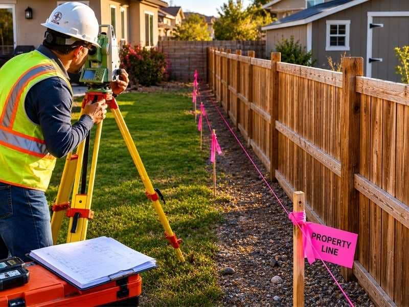
Land Surveyors are professionals who make precise measurements to determine the size and boundaries of a piece of real estate. While this is a simplistic definition, boundary surveying is one of the most common types of surveying related to home and land owners. If you fall into the following categories, please click on the appropriate link for more information on that subject:
Phoenix Land Surveying services:
I need to know where my property corners or property lines are. (Boundary Survey)
I have a loan closing or re-finance coming up on my home in a subdivision. (Lot Survey)
I need a map of my property with contour lines to show elevation differences for my architect or engineer. (Topo Survey)
I’ve just been told I’m in a flood zone or I’ve been told I need an elevation certificate in order to obtain flood insurance or prove I don’t need it. (Flood Survey)
I’m purchasing a lot/house in a recorded subdivision. (Lot Survey – See Boundary Survey if you’re not in a subdivision.)
I’m purchasing a larger tract of land, acreage, that hasn’t been subdivided in the past. (Boundary Survey)
Contact Phoenix Land Surveying services TODAY at (602) 600-6678.
Every piece of land tells a story, but some properties are much harder to understand than others. Flat lots are usually easy to evaluate. However, steep hills, thick forests, hidden valleys, and rocky areas can make the land difficult to read. Standard aerial photos often miss important details. That is where LiDAR Mapping provides a better view.
By using laser measurements, professionals can see the true shape of the ground beneath trees and vegetation. This creates a clearer picture and helps property owners make better decisions.
Some Pieces of Land Cannot Be Explained by a Quick Look
A quick drive-by inspection may work for a flat lot, but unusual properties demand a closer look. Some sites contain rocky ridges, seasonal streams, or sinkholes that are not visible from the road. A basic map often fails to show these important features.
Interesting terrain requires more attention because the surface does not always tell the whole story.
Unique landscapes affect nearly every stage of planning. Builders cannot simply guess where stable soil exists or where stormwater may collect. Thick trees and brush can hide major changes in elevation. Taking the time to study these areas helps prevent costly surprises later.
Simple Assumptions Do Not Always Match Reality
Many people assume the land follows smooth slopes and straight lines. In reality, the earth rarely behaves that way. A hill that appears gentle on a map may actually be too steep for equipment or construction.
Foundations may shift if soil conditions are misunderstood. Driveways can become difficult to use if slopes are too steep. Drainage problems may also appear after construction.
Professionals avoid these issues by relying on accurate measurements instead of guesses. Understanding the natural shape of the property allows designs to work with the terrain rather than against it.
Patience Often Reveals the Best Features of a Site
Rushing through land evaluation can create problems that are costly to fix. Water movement, soil conditions, and elevation changes all affect how a property should be developed.
Careful analysis helps property owners discover the strengths of the land.
For example, a hidden flat area may provide the perfect location for a building. A natural rock formation may offer protection from strong winds. Working with the existing landscape often leads to better long-term results.
LiDAR Mapping Brings Clarity to Challenging Terrain
Measures how long each laser pulse takes to return.
Calculates the exact elevation of the ground.
Removes trees and vegetation from the digital model.
Creates a detailed map that shows ridges, valleys, and low areas.
This information gives engineers, developers, and property owners greater confidence when making decisions. Instead of guessing, they can clearly see the slopes and natural features of the land before construction begins.
Distinctive Properties Often Have the Greatest Value
Many memorable homes, parks, and developments are built on sites with interesting landscapes. Rolling hills, streams, and rock formations create beauty and character that flat land cannot always provide.
LiDAR Mapping allows owners to preserve these natural elements while building safely. Structures can be placed to maximize views and avoid hazards such as unstable slopes or flood-prone areas.
Understanding the unique character of a property makes it possible to turn challenging terrain into an asset instead of an obstacle.
Frequently Asked Questions
Why do some properties need more detailed analysis?
Some sites contain hidden features such as underground drainage paths, steep slopes, or dense vegetation. A basic inspection may overlook these conditions, making a more detailed evaluation necessary.
Can unusual terrain affect development plans?
Yes. The shape of the land influences where foundations, roads, septic systems, and drainage structures should be placed. Discovering these conditions early helps avoid costly changes later.
How does LiDAR Mapping help with complex sites?
LiDAR Mapping uses laser pulses to measure the ground beneath trees and brush. It creates detailed three-dimensional models that show the true shape of the terrain without clearing vegetation.
Is LiDAR Mapping only useful for large properties?
No. Even small lots can contain drainage problems, steep slopes, or unstable areas. Accurate terrain information is valuable for properties of all sizes.
Why is patience important when evaluating land?
Taking time to understand the property helps reveal how water, soil, and elevation affect the site. Rushing the process can lead to expensive repairs and design changes after construction begins.
Planning a big project like a dam inspection takes a lot of careful thought. Your own backyard projects need that same exact care when they start getting personal. Many people think property lines only matter when they buy a house or get into a big fight with a neighbor. However, deciding to change your yard brings up brand-new questions about where your land ends and where the next lot begins. A professional boundary survey gives you the clear facts you need so you can build without any stress. When you map out your land boundaries the right way, you protect your hard-earned money and your peace of mind at the same time.
Some Projects Say More About the Owner Than the Property
Building a basic backyard shed is usually just about finding extra storage space. However, creating a custom outdoor kitchen or a big workshop is a totally different story. These larger projects are not just about adding resale value to a house or fixing a broken fence. Instead, they show off your personal style, your favorite hobbies, and the exact way you want to enjoy your life every day. People build these custom spaces because they want a specific spot to work on cars, cook meals for friends, or host visiting family members.
Because these additions match your lifestyle so closely, you want them to be absolutely perfect. You spend a lot of time choosing the paint colors, the layout, and the building materials. It would feel awful to find out later that a project you care about so much was built in the wrong spot. Checking your property lines early ensures that your personal hard work stays safe for many years to come.
The Backyard Starts Feeling Like an Extension of Daily Life
Over the years, a yard stops being just a patch of green grass and it becomes a major part of your regular routine. Morning coffees happen on the back porch, kids play catch near the bushes, and summer dinners move outside under the shade trees. The outdoor space slowly turns into a collection of family traditions and quiet memories. Homeowners begin to view these outdoor areas as real rooms without walls, so they want to treat them with the same respect they give their indoor spaces.
When you start seeing your land this way, you naturally want to make it feel more private and comfortable. You might think about putting up a tall wooden fence, planting a row of privacy hedges, or pouring a permanent concrete patio. These choices are all about protecting your personal peace, which makes the exact placement of every single item matter much more than it ever did before.
Personal Spaces Deserve More Than Educated Guesses
When a project means a lot to your family, relying on an old fence line or a neighbor’s memory is a huge mistake. People often guess where their property ends by looking at where the grass is mowed or where an old iron pipe sits in the dirt. These visual signs are frequently wrong because previous owners might have made simple handshake agreements that never showed up on official county maps.
Spending thousands of dollars based on a guess can lead to terrible surprises, like a neighbor asking you to tear down a brand-new patio. True certainty is the only way to protect your emotional and financial investment. Getting real measurements removes the fear of making a mistake, and it lets you focus entirely on the fun parts of building.
Boundary Survey Information Supports Plans Built Around Lifestyle
A proper property scan provides the factual foundation for all your big ideas, and it keeps you from causing arguments with the people next door. This special map does not just protect you from legal trouble, but it also helps you use every single square foot of your dirt. Knowing the exact limits of your land allows you to place a new swimming pool or a guest house right up to the legal line, and you will not have any fear of breaking city rules.
The formal paperwork shows the exact location of underground utility lines.
The map highlights any shared driveways or walkways that you must keep clear.
The final document gives your construction team clear markers to follow during digging.
This clear data gives you the green light to use your land exactly the way you want. You can design your dream yard with total freedom because you have an official document that proves your plans are perfectly fine.
The Best Improvements Reflect the People Who Use Them
Houses change right along with the people who live inside them, and the best properties match the changing needs of a growing family. A yard that used to hold a simple swing set might now be the perfect spot for a large vegetable garden or a private art studio. When you build spaces that match your actual life, your entire home feels more authentic and useful.
Using reliable property facts is simply the first step in making sure those custom spaces belong to you forever. When you combine your creative vision with accurate measurements, you create a beautiful space that your family can enjoy safely for decades.
Frequently Asked Questions
Why do homeowners care more about boundary information during major projects?
Large projects cost a lot of money and reflect long-term family goals, so owners want to be completely sure they are building safely on their own land. Having exact details prevents costly mistakes and ensures the new structure is legally safe forever.
Can a Boundary Survey help with outdoor improvements?
Yes, this map shows exactly where you can place pools, patios, and detached garages without crossing your neighbor’s line or breaking city distance rules. It helps your construction crew put everything in the perfect spot from day one.
Is a Boundary Survey only useful when buying property?
No, many people get their land scanned long after moving in because they want to upgrade their yards or build new additions. It is a smart tool for any current homeowner who wants to make sure their new building plans are accurate.
Why do outdoor spaces become more important over time?
As routines change and families grow, yards become central places for relaxing and entertaining guests. They start feeling like real extensions of the indoor house, which makes owners want to invest more time and money into fixing them up.
How does a Boundary Survey support personal projects?
It gives you absolute proof of your land borders, which eliminates guesswork and allows you to build with complete confidence. This accurate information keeps your project on track and protects your hard work from future legal problems.
Maricopa County added 57,471 new residents in 2024 alone. That makes it one of the fastest-growing counties in the country. More growth means more fences, more additions, more driveways, and more property line disputes ending up in court. A boundary survey is the clearest, most legally reliable way to confirm where your land begins and ends. If you’ve never had one done, the information below is worth your time.
What Is a Boundary Survey?
A boundary survey is a formal measurement of your property lines. It’s carried out by a licensed land surveyor. The surveyor establishes your exact legal boundaries using public records, historical deeds, and physical fieldwork. The finished product is a certified map. Courts, lenders, and title companies all treat it as the authoritative record of your property.
The process starts at the courthouse. The surveyor pulls your deed, neighboring deeds, county plat maps, and any past filings tied to the parcel. Then they head into the field. They physically locate your property corners and mark them with iron rods or pins. The completed drawing shows exactly where your lot starts and stops. It also flags any encroachments or easements that affect your land.
In Phoenix, a standard residential boundary survey typically runs between $600 and $900 for a platted subdivision lot. Properties with unclear deed histories or irregular shapes may cost more. Most fall within that range based on 2025 project data across Maricopa County.
What Gets Documented in the Survey
The exact location of all property corners, physically marked in the field
Legal boundary lines drawn from your recorded deed
Any encroachments from neighboring structures, fences, or driveways that cross your line
Recorded easements that run through or border your property
A certified survey plat showing all of the above to scale
Why Boundary Conflicts Are More Common in Phoenix Right Now
Phoenix’s metro population reached 4.887 million in 2026, up from 4.777 million just two years earlier. That kind of sustained growth puts constant pressure on established neighborhoods. Builders squeeze new homes into gaps between existing lots. Homeowners replace old fences, add pools, or expand driveways without pulling a current survey first. Most go by an old plat map. Many assume the existing fence is correct.
A lot of the time, it isn’t.
In older Phoenix neighborhoods like Laveen, Maryvale, and South Mountain, original property markers are often missing, damaged, or buried under years of landscaping. When a neighbor pours concrete or sets fence posts without checking the recorded lines, they can end up two, three, or even ten feet onto your property. They often don’t know it. By the time anyone figures it out, the structure is finished. The conversation gets a lot harder from there.
How a Boundary Survey Holds Up in a Dispute
Say your neighbor builds a shed three feet inside your property line. Without a current survey, it’s your word against theirs. With one, you have a certified legal document. It shows exactly where the boundary is and exactly how far the encroachment extends. Property dispute attorneys consistently point to the survey as the strongest piece of evidence a homeowner can bring to the table. A verbal claim or an old plat map doesn’t carry the same weight in court.
Arizona also has a legal doctrine called “boundary by acquiescence.” Under this rule, if two neighbors have both treated an informal line as the true boundary for a long period of time, a court can declare it legally binding. This can happen even if it contradicts the recorded deed. It’s a real and underappreciated risk. In neighborhoods where fences have sat in the wrong place for twenty or thirty years, the exposure is significant. A boundary survey done before any dispute arises locks in the legal line. It removes the ambiguity that acquiescence claims depend on.
When to Get a Boundary Survey
Most homeowners only think about a boundary survey after a conflict has already started. That’s the wrong time. By then, attorneys are involved and money is being spent. What could have been resolved quickly has turned into something drawn out.
The smarter approach is to get ahead of it. Here are the situations where a survey makes the most sense.
Before any construction near your lot line
Fences, pools, detached garages, backyard additions, anything built close to the edge of your lot carries risk. Going even a few inches over the line can result in a demand to tear the structure down. A survey before you break ground eliminates that risk.
When you close on a home without a current survey
Many buyers skip the survey at closing to trim costs. That leaves you without a verified record of what you actually purchased. Encroachments and easement conflicts that existed before you moved in become your problem after the fact.
When a neighbor begins construction near the shared line
Getting a survey done before a structure goes up gives you documented proof of where your line is. Trying to resolve it after the concrete is poured is far more complicated and expensive.
Before you list the property for sale
Buyers, lenders, and title companies are requesting current surveys more often. Having one ready before you list can prevent delays at closing and remove a common point of negotiation.
What Happens During the Survey
After the courthouse research is complete, the surveyor goes out to the site. They look for existing monuments: iron pipes, rebar, concrete posts, or other physical markers set during earlier surveys. Those monuments are compared against the recorded deed to verify whether the ground matches the documents.
Where markers are missing, the surveyor reconstructs the boundary from the best available evidence. That includes neighboring monuments, adjoining deeds, occupation lines, and physical site conditions. Once the analysis is complete, missing corners are set and the boundary is marked.
The final deliverable is a certified survey plat. It shows your lot boundaries to scale, the location of structures relative to those lines, any encroachments found, and any easements recorded against the property. That document is your legal record and remains useful for as long as you own the property.
The Cost Compared to the Alternative
Based on 2025 project data, homeowners paid between $244 and $919 for a residential boundary survey. Most fell in the $452 to $589 range. Complex lots, messy deed histories, and heavily built-up parcels push that number up.
Property line litigation is a different story. Legal fees alone in a boundary dispute routinely run into the thousands. Cases that go to court can cost far more. A survey ordered before a conflict develops costs a fraction of what it costs to resolve one after it starts.
Phoenix is not slowing down. New construction and infill development will keep pushing on established lot lines. Knowing where your property lines are is a practical step toward protecting what you own.

 Land Surveyors are professionals who make precise measurements to determine the size and boundaries of a piece of real estate. While this is a simplistic definition, boundary surveying is one of the most common types of surveying related to home and land owners. If you fall into the following categories, please click on the appropriate link for more information on that subject: