
Why a Topographic Survey Matters Before Grading a Desert Lot
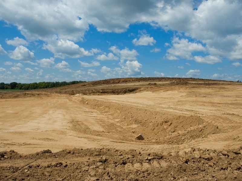
A grading crew shows up on a lot. They cut and fill the ground to match the plan. Two months later, a monsoon storm sends water straight into the garage. The site looked flat enough during the walk through. Nobody had actually measured how the land drained until it was too late to fix without spending a lot of money.
Desert land hides more than it shows. A lot can look level to your eyes, but it can still carry a slope that sends water in a direction nobody planned for. A topographic survey is the tool that catches this before grading starts, not after.
Understanding Desert Terrain Before Grading Begins
Desert lots across the area often sit on land shaped by years of rare but heavy rainstorms. This includes alluvial fans, washes, and gently sloped ground. Land that looks flat and easy to build on can carry small grade changes that only show up once someone measures them.
A topographic survey maps the exact height of the land across a property. It shows high points, low points, and the slope between them. For a desert lot, this data shows things a simple look around cannot catch, like natural drainage paths that only carry water during storms.
Phoenix keeps growing into areas with rockier or more uneven land, including parts of North Phoenix and the foothills near the Sonoran Preserve. Lots in these spots usually need more careful grading planning than flatter land closer to the city center.
Why Desert Soil Adds Another Layer
Desert soil often does not soak up water well. Water sits on top of the ground longer instead of sinking in. Mix that with a slope nobody noticed, and you get why grading mistakes on desert lots usually show up as drainage problems, not building problems.
Using Elevation Data to Plan Accurate Grading
A grading plan is only as good as the height data behind it. A topographic survey gives an engineer or contractor the measured points they need. This helps them set the right pad height, driveway slope and drainage path for the real land shape.
Elevation data from a topographic survey usually helps with:
- Setting the right building pad height compared to the land around it
- Figuring out how much dirt to cut or add before work begins
- Designing driveway and access slopes that meet local grading rules
- Making sure the site drains away from buildings instead of toward them
- Finding spots where retaining walls or extra grading work may be needed
Without this data, a grading plan is based on guesses instead of real numbers. On a desert lot, where the land can trick your eyes, that gap between guessing and reality is where expensive problems begin.
Identifying Drainage Challenges on Desert Properties
Drainage is often the biggest risk on a desert grading project. Monsoon storms in the area can drop a lot of rain in a short time. A lot that does not handle that water well can end up with erosion, flooding or damage to buildings.
A topographic survey helps find:
- Washes or natural drainage paths that cross the property
- Spots where runoff piles up instead of spreading out
- Places where water from a neighbor’s land flows onto the site
- Low spots that could hold water after grading changes the natural flow
- Places where drainage easements or flood zone lines might apply
Some desert lots near washes or low ground sit inside a mapped flood zone. This can mean extra permit steps. Check the flood zone status with the City of Phoenix or the Maricopa County flood control office before you finish a grading plan. This can change what paperwork your project needs.
Coordinating Earthwork Plans With Existing Site Conditions
A topographic survey only helps if the grading and earthwork plans actually use the data it gives you. This step is where many projects run into problems that could have been avoided.
Make sure your civil engineer or grading contractor uses the same height starting point and survey data used to design the site plan. If the survey and the earthwork plan come from different sources, mismatched starting points can lead to a pad graded to the wrong height.
Ask your surveyor to give you:
- Height data in a digital file your engineer or contractor can use right away
- Clear labels showing the benchmark and datum used
- Notes about any drainage features, washes or flood zone areas on the property
Ask your contractor to confirm, before earthwork starts, that the grading plan matches the current survey. It should not match an older site plan or guessed heights. This one check catches most grading mistakes before they turn into costly rework.
Reducing Grading Risks With Detailed Site Measurements
Grading mistakes on desert lots cost a lot to fix once concrete is poured or landscaping is in place. Detailed site measurements up front cost far less than fixing drainage problems later.
Before starting grading work on a lot, make sure you have:
- A current topographic survey showing height, drainage and site features
- Confirmation of flood zone status if the lot sits near a wash or low ground
- A grading plan that uses the same height data as the survey
- Any permits the city or county requires for grading near a flood zone or wash
- A clear plan for sending drainage away from buildings and toward the right outlet
Timing matters if your project has a start date or a permit deadline. Order the topographic survey early enough that the grading plan can be built around real data, instead of fixed later. Rules can be different depending on the city, the lot location and the size of the project. Check your specific needs with the local permit office before you finish your plans.