
When Boundary Surveying Helps Before Removing an Old Block Wall
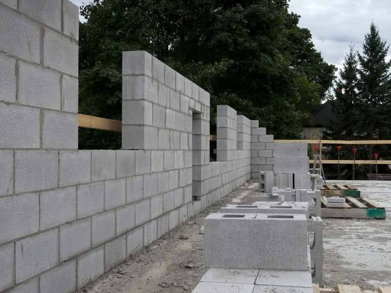
Block walls have separated backyards for decades. Many homeowners assume the wall sits right on the property line. That assumption is often wrong.
Boundary surveying tells you exactly where your property line falls, regardless of where an old wall happens to sit. Before you tear down a wall or plan a replacement, this information can save you from a dispute with a neighbor or a rebuild in the wrong spot.
If you’re planning to remove or replace a block wall in the area, here’s what boundary surveying can tell you and why the timing matters.
Why an Old Block Wall May Not Mark the Boundary
Many neighborhoods were built decades ago, and walls were often placed based on visual estimates rather than surveyed lines. A contractor or previous owner may have built close to the line, not exactly on it.
Over time, walls can also shift. Soil movement, root growth and general settling are common across the Valley, especially with the area’s clay-heavy soil in some neighborhoods. A wall that started near the line can drift further off over the years.
Common reasons a wall doesn’t match the true property line include:
- Original construction based on estimates instead of a survey
- Later repairs or rebuilds that shifted the wall’s position
- Fence or wall lines drawn to avoid trees, utilities or slopes
- Old surveys or plats that used different reference points than current standards
None of this means anything is wrong with your property. It just means the wall’s location and the legal boundary line are two different things until a survey confirms otherwise.
Locating the Property Line Before Demolition Begins
Boundary surveying uses recorded deeds, plats and physical evidence to establish the true legal boundary of a property. A licensed surveyor researches the property’s history, then confirms the line in the field using measurements and existing monuments like pins or markers.
This matters most right before demolition. Once a wall comes down, the visual reference point disappears. If a dispute comes up later about where the line actually sits, having survey data from before demolition removes the guesswork.
This is especially useful, where many properties share walls between adjacent homes or back up to shared alleys and easements. Knowing the exact line before you start removing anything protects you if questions come up during or after the project.
Comparing the Wall Position With Surveyed Property Corners
Once the survey establishes the true boundary, the next step compares that line to where the existing wall actually sits. This comparison usually falls into one of a few outcomes.
The Wall Sits On or Very Close to the Line
In this case, a replacement wall built in the same location generally stays within your property rights, assuming no other restrictions apply.
The Wall Sits Entirely on Your Property
This means your neighbor’s usable yard space may be slightly larger than the wall suggests. A rebuild in the same spot is usually fine, but this is worth discussing with your neighbor.
The Wall Crosses Onto a Neighbor’s Property
This is the situation that causes the most friction. If the wall sits partly or fully on a neighbor’s land, both parties may want to agree on where a new wall should go before construction starts.
A surveyor can mark the true corners and line on site, giving both property owners a clear, shared reference point.
Planning a Replacement Wall From Verified Boundary Information
Once you know exactly where your line sits, planning a replacement wall becomes far more straightforward. You can decide with confidence whether to rebuild in the same spot, adjust the position or negotiate a shared agreement with a neighbor.
Verified boundary data also helps with:
- Confirming the new wall won’t encroach on a utility easement
- Checking setback requirements that may apply to walls near property lines
- Avoiding a rebuild that has to be moved again later due to a boundary dispute
- Giving your contractor exact reference points for accurate placement
Setback and easement rules can vary by lot, neighborhood association and municipality. If your property falls under an HOA or specific zoning overlay in the Phoenix area, confirm any wall height or placement rules before finalizing your plan.
Coordinating Survey Information Before Wall Construction Starts
The best time to bring in a surveyor is before demolition, not after a dispute starts. This gives you accurate information while you still have full flexibility in your plans.
Steps worth taking before construction begins:
- Order a boundary survey to confirm your property lines and corners
- Compare the surveyed line to the current wall position
- Discuss findings with your neighbor if the wall sits off the line
- Confirm any setback, easement or HOA requirements that apply to the new wall
- Give your contractor the surveyed corners and line so the new wall gets placed correctly the first time
Requirements for wall placement, height and setbacks can vary by municipality, HOA and lot type across the area. Confirm your specific requirements early, especially if a permit or inspection depends on the wall’s final location.
Frequently Asked Questions
Do I need a survey to remove a block wall?
A survey isn’t always required by permit rules, but it’s a smart step if you plan to rebuild or if the wall’s exact location isn’t clear. It protects you from disputes and placement mistakes.
What if my neighbor disagrees with the survey results?
A licensed survey is based on recorded legal documents and field measurements, which gives both parties a factual reference point. If a disagreement continues, both property owners may want to review the findings together with the surveyor or seek legal guidance.
Can I just measure from the old wall instead of getting a survey?
Measuring from an existing wall assumes the wall is accurate, which is often not the case. A survey confirms the actual legal boundary instead of relying on an assumption.