↓
 

Phoenix Land Surveying

Local Land Surveyors in Phoenix, AZ

Phoenix Land Surveying
  • Home
  • ALTA Survey
  • Boundary Surveying
  • Construction Survey
  • Drone LiDAR Mapping
  • Elevation Certificate
  • Land Surveying
  • Lot Survey – Closing Survey
  • Topographic Survey
  • Contact Us
Home - Page 3 << 1 2 3 4 5 6 >>

Post navigation

← Older posts
Newer posts →

The Basics of Land Surveying

Phoenix Land Surveying Posted on August 11, 2015 by PhoenixSurveyorFebruary 19, 2018

What is Land Surveying?

Land Surveying dates back to ancient history. Surveying is used for multiple projects.  A survey is done to establish a specific location of a parcel of land along with its exact acreage.  It is used to ascertain boundaries for defining an area of ownership and tax liability.  It is also used to identify a piece of property by a written legal description or to provide a review of the accuracy of an existing description. Data from land surveying is of the utmost importance with regard to buying and selling land, and is also used to insure a clean and marketable title.

Other types of Land Surveying

There are many different kinds of surveys that can be performed. Boundary surveying is typically done for undeveloped land. This type of survey measures the actual physical extent of the property in question. Most surveys progress through the basic procedures regardless of the type being done. Any pertinent deeds, contracts, maps or other documents that contain a description of the property’s boundaries are located, studied and interpreted.

A determination is made of what the actual property description is deemed to be, along with the locations of any physical evidence of the boundaries. This can be in the form of both natural and man-made monuments or markers that exist in the field.

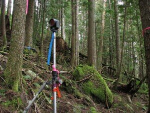
The property is then measured to establish the boundaries, not only using the appropriate existing monuments but with the creation and referencing of new markers where necessary. Measurements are accomplished using a total station and other land surveying tools. A total station measures both vertical and horizontal angles, as used in triangulation networks. After these steps are accomplished, the property description and plat are prepared.

Results of land surveying

Interpreting the results of a land survey is not as difficult as it may first seem. For instance, a property plat will usually contain a directional orientation which is typically indicated with an arrow pointing north. It will contain the bearing and distance of each boundary line, the property lines of other properties shown on the plat, and the names of adjacent property owners listed in the areas of their property.

Corner monuments, along with the names of any natural monuments (such as “Smith’s Creek”, for example) or a brief description of any unnamed natural monuments (such as the “30-inch pine tree”) are on the plat. There is also a title block containing the property’s location and name of owner, the surveyor’s name, the date the survey was performed, the scale of the plat and any other relevant data.

If you need the services of a surveyor for your land surveying needs, ALWAYS be sure that you’re hiring an experienced, certified, and highly competent professional surveyor. You can find out if the surveyor is licensed by visiting the Board of Licensure’s website.

Posted in land surveying, land surveyor | Tagged boundary survey, land survey, Land Surveying, plat

What Is A Land Surveyor?

Phoenix Land Surveying Posted on July 28, 2015 by PhoenixSurveyorMarch 6, 2018

Land Surveyor

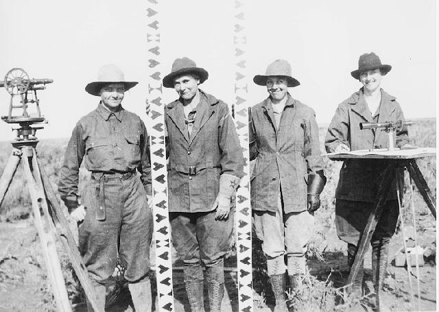
A Land Surveyor is essential whenever you plan on building a house, buying or selling a property, or dividing your property amongst your children. Many land surveyor made it down to history.

In fact, three of the four faces carved in Rushmore are land surveyors (Presidents George Washington, Thomas Jefferson and Abraham Lincoln were all three surveyors, Teddy Roosevelt was not.).

Others popular names were Daniel Boone, Meriwether Lewis and William Clark (Lewis & Clark), Sir George Everest, Charles Mason & Jeremiah Dixon (of the Mason-Dixon Line fame) and author Henry David Thoreau practiced for a time in Concord, Massachusetts.

What is a Land Surveyor?

Aland surveyoris a person with the academic qualifications and technical expertise to measure and plot the lengths and directions of boundary lines and the dimensions of any portion of the earth’s surface (including natural and other structures). That definition is quite a mouthful, but in actuality the field of surveying (geomatics) includes many other facets.

If you plan to purchase a lot, build your dream house, divide your property to your children, or simply want to know the details of a land property, a land surveyor is the best person to help you out. A land surveyor locates theboundaryof your property and the location of your home within that boundary to determine if there are any encroachments by your neighbors onto you or vice versa. Common encroachments are fences, driveways, etc.

These days a land surveyor in the United States is regulated and licensed by the various state governments. In Arizona, theArizona State Board of Licensure for Professional Engineers and Land Surveyorswas established in 1935 to protect the public.  A land surveyor’s duty is “to safeguard life, health, and property, and to promote the public welfare by providing for the licensing and regulation of persons in the practices of engineering and land surveying. This purpose is achieved through the establishment of minimum qualifications for entry into the professions of engineering and land surveying, through the adoption of rules defining and delineating unlawful or unethical conduct, and through swift and effective discipline for those individuals or entities who violate the applicable laws or rules.”

How to become a land surveyor?

As of 2007, a newly licensed land surveyor is required to finish a four year degree in surveying or a closely related field, a four to eight years of on-the-job training under a licensed practicing surveyor. In addition to that, licensed land surveyors are mandated to attend 15 hours of continuing education annually to ensure that they are kept updated with the new know-hows that would help them on their professional growth.

What does a land surveyor do?

As part of a standard lot or mortgage survey of a property, expect your land surveyor to review tax maps, aerial maps, deeds, subdivision plats, zoning ordinances, subdivision regulations and possibly even flood maps. For a typical lot survey, the subdivision plat is the most important of these because it tells the exact dimensions of your lot and the relative location of your property corners. The surveyor uses this to locate and/or re-establish your property corners.

In the field, a land surveyor will search for your property corners along with some of your neighbors’ corners. If yours can’t be found, they’ll measure the distances and angles between all of the points, locate the improvements on your property, including your house, pool, out-buildings, retaining walls, fences, driveways, sidewalks, and other home improvements. Other improvements like sanitary sewer mains, storm drainage ways, overhead power lines and the like are located because these might indicate an easement across the property. The plat should show these, but may not in all cases.>

Once all of the field information is gathered, the crew chief takes the field notes and prepares a preliminary sketch of the work. This is passed along to a draftsperson who prepares the final outline for your use. The draftsperson will check all of the maps mentioned earlier to make sure that all building setback lines and easements are shown on the draft. The surveyed distances and directions are compared to the plat distances and directions as well. Any discrepancies or encroachments are shown on the drawing. Your lawyer may use the draft to determine if any other legal work is needed during the closing. The mortgage company or the bank may also use the survey for their records.

So now, what do you have for your money. You have a drawing which shows your house on your lot. You should have stakes and/or flagging by all of your property corners. Make sure you know where they are located. The actual corner is marked by an iron pin or pipe of some sort. (The type of monument should be shown in your survey drawing.) You might also want to take a look at them at least once a year to make sure they’re still there. (Even animals mark their territory more often than that.)

Posted in construction, land surveying, land surveyor | Tagged boundary survey, land survey phoenix, land surveyor, what is a land surveyor

Flooding From Excessive Rain Downstream From Earth Dams

Phoenix Land Surveying Posted on July 21, 2015 by PhoenixSurveyorMarch 6, 2018

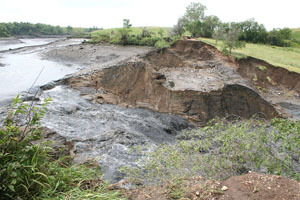
The Daily Republic in South Dakota published an article that talks about an earthen dam that recently failed because of a nine-inch rainfall last 29th of July 2010. The heavy rainfall overwhelmed the dam’s capacity causing it to fail.

No injury was reported on the said event. The said damn was built in 1935, as were a number of them during the Work Programs after the Great Depression. In 2007, it was inspected by a Department of Game, Fish and Parks Engineer and he noted that they “were satisfied with the condition of the dam” during that time. It was then again inspected in 2008 and it was said that the dam breach “was caused by an extraordinary natural event and not by any structural weakness in the dam.” (Photograph by Laura Wehde/The Daily Republic).

Earth dams are almost too numerous to count around the country. In fact, you might just be living near one without you knowing it. A great percentage of these dams were built over 70 years ago and, in many cases, the owners today were not the same ones when they were initially built. For this reason, maintenance and inspection of these dams became less popular.

FEMA estimates “there are over 80,000 dams in the United States”, and that approximately “one third of these pose a ‘high’ or ‘significant’ hazard to life and property if failure occurs.”

The South Fork dam, the country’s worst dam failure disaster in May of 1889, took over 2200 lives and almost half of which were under 20 years old. This incident happened in the town of Johnstown, PA, thus it was known as the “Johnstown Flood”. A 37-foot high wall of water hit Johnstown, located 9 miles downstream from the dam. It almost destroyed the entire city as 1600 homes and 280 businesses was flushed away.

In March 1928, the St. Francis Dam in California also failed. This caused a legislation to be enacted in and around the said state. This, and other later legislation led to life-saving advance warning when the Baldwin Hills dam near Los Angeles, California failed on December 14, 1963. Because of the advance warning which enabled the evacuation of approximately 16,500, the casualties from dam failures has significantly decreased to 5 individuals

Even though there have been far less loss of lives in the United States from dam failures since the 1970’s, reports that…

there were 132 dam failures and 434 “incidents” between January 2005 and January 2009.

Of course, It should be noted that the failure of the earthen levees near New Orleans, LA during and after Hurricane Katrina are purported to be responsible for killing more than 1000 people.

Failure in The KaLoko Dam on the Island of Kauai, Hawaii in March 2006 has resulted to the death of 7 people. Two years after the said incident, developer James Pfluegar was indicated for manslaughter and reckless endangerment in relation to the dam failure. The incident had caused the country of Kauai and the State of Hawaii to pay out over $9 Million in of lawsuits after the failure.

Cause of Dam Failures

Heavy rains cause overtopping, which is by far the most common cause of dam failures. Dam spillways and structures are typically not designed for more than a 1-percent chance (aka 100-year) storm event. When a rain event exceeds this, the water starts to travel outside of the control spillway. This causes erosion of the soil on the dam from the excessive amount of water traveling over it. It is also possible for overtopping to occur from smaller rain events because of debris blockage of the outlet structure or spillways or because of settlement of the dam crest.

Foundation defects, including settlement and slope instability, cause about 30% of all dam failures.

Seepage or Piping causes the remaining 20% of the U.S. dam failures. Piping is the internal erosion caused by seepage under and through the dam. This usually happens around structures such as pipes through the dam and spillways. Seepage can also be caused by animals, like beavers, muskrats, groundhogs, and other rodents, burrowing in the dam, by roots of trees growing on the dam, and through cracks in the dam.  All earth dams have seepage resulting from water permeating slowly through the dam and its foundation. But this seepage must be controlled or it will progressively erode soil from the embankment or its foundation, resulting in rapid failure of the dam.>

What Should You Do To Protect Home?

Since the failure of a dam causes flood, your best option is to avoid building in a flood zone, unless you elevate and reinforce your home. Have your area surveyed and investigated for dam failure and flood determination so you’ll know if your dream house is safe to be constructed in that certain area.

Do you live downstream from a dam? Is the dam a high-hazard or significant-hazard potential dam? To find out, contact your state or county emergency management agency and/or visit the National Inventory of Dams. There are around 2,228 dams on the National Inventory in Arizona. And among those, 636 are listed as high or significant hazard potential dams.

If you live downstream from one of these dams, find out who owns and regulates the dam. This information should also be available from the National Inventory of Dams.>

Next, find out if there is an Emergency Action Plan in place. Again, consult your state or county emergency management agency. (Arizona Emergency Management Agency)

Strangely enough, Arizona is the only state in the United States that has not passed dam safety legislation.

Posted in flood damage, flood survey, land surveyor | Tagged dam failure, flood, flood survey, flooding

Post navigation

← Older posts
Newer posts →
Get Quote Button
© 2025 Phoenix Land Surveying
Phoenix, Arizona
Phone: (602) 600-6678

Web Development and SEO by:
N2Biz.co


Privacy Policy | Terms of Use

The owner of this website, USA Surveying & Engineering, LLC., provides coordination of professional land surveying and engineering services in all 50 states. The professional surveying and engineering services provided to you will be conducted by fully licensed professionals in your state.

↑